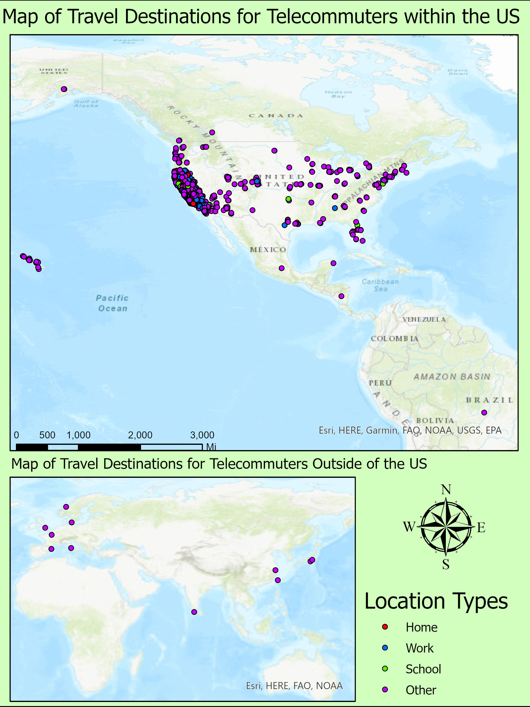
Introduction to Research

Brief tutorials that introduce my background and capabilities.

These tutorials are dedicated to those wishing to become more aquainted with Data Science and programming software. I've been called many things, but I feel that "teacher" comes to mind as the most frequently used adjective.

If you don't own/use any of the provided services requiring subscribed access, don't worry! While it may be a steep learning curve, you can accomplish the same task with freely avaliable software. These are basically light versions of old classwork and w3schools tutorials. It may be best to select a single language to understand how syntax and data structures can impact a program's behavior.

Statistics

The heart of Machine Learning and Artificial Intelligence

This is from the independent studies class I took with Kostas Goulias. Here I had to go through NHTS data to create a spatial distribution of telecommuters and commuters.

ArcMap

Maps I created in ArcMap Pro, by ESRI

Geog 199

The second map isn't much different, depicting telecommuters and their travelling habbits throughout the US. I did these in ArcMap, and I would have loved to revisit these maps and the data in R, however the COVID 19 pandemic cut the time I was supposed to meet and interact with my adviser.

London Pump Analysis

Here is a map I created in a class at UCSB in which we digitally replicated the Broad Street cholera outbreak, a severe outbreak of cholera that occurred in 1854 near Broad Street in the Soho district of the City of Westminster, London, England. This was an assignment to get us used to the idea of solving problems using the power of GIS. After displaying the locations and numbers of deaths due to cholera, we deduced that the number of these deaths were exceptionally higher near sewage pumps, leading to the theory that these pumps were mismanaged/poorly inspected. These same deductions were the same found by John Snow (not the GOT version) who at that time had found the same results.

Geog 176 Series Result

A poster I created with a fantastic group for my Geography 176C class, the final course in a Geographic Informational Sciences series. Here we had to collect all our own data and come up with a GIS related question/theory, display, and present our findings to our peers. All edits were done in ArcGIS Pro 2.3.x

R and RStudio

Introduction to Geographic Research

California COVID-19 Transmission Rate vs Income Display

This is a basic bi-variate map displaying the case and death relationships to average county income. Here anything that is more red indicates a higher average income, and low average deaths while anything more blue indicates a higher death and case count in areas that have lower average income. There are two types of income data, household income and per capita income to see if there's any variation in results. The case and death counts have also been normalized to 100,000 people, which makes areas such as LA and San Francisco (areas with high counts but due to extremely high populations)

Flooding Analysis Start Map

Here you see the beginnings of a flooding analysis raster. For fear accidentally sharing confidential resources and out of respect for my peers, I did not want to display data that [was] in the process of being published. This is a basic map consisting of a DEM Raster and Poly lines representing the Russian River in California that is the beginning for flood prediction and analysis.